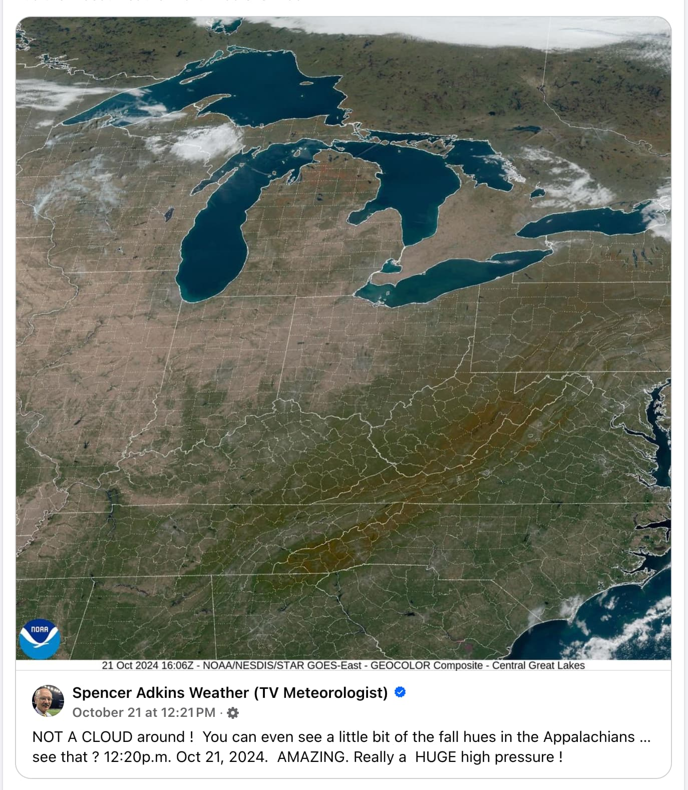
Flying Squid@lemmy.world to Mildly Interesting@lemmy.world · 4 months agoThe eastern U.S. was so cloudless last week due to a massive high pressure system that you could actually see fall colors from space.lemmy.worldimagemessage-square3fedilinkarrow-up11arrow-down10
arrow-up11arrow-down1imageThe eastern U.S. was so cloudless last week due to a massive high pressure system that you could actually see fall colors from space.lemmy.worldFlying Squid@lemmy.world to Mildly Interesting@lemmy.world · 4 months agomessage-square3fedilink
minus-squareEABOD25@lemm.eelinkfedilinkEnglisharrow-up1·4 months agoWhoa I didn’t know you could see state and county lines from space. I guess maps are more realistic than I thought!
minus-squareanonemoose@lemmynsfw.comlinkfedilinkEnglisharrow-up1·4 months agoImagine how much work it must be to chalk those lines every time it rains.
minus-squareassembly@lemmy.worldlinkfedilinkarrow-up1·4 months agoBro this ain’t the 1800s, we’re obviously using LED light strips for that now. The downside is that a single section goes dark and we lose mapping data for the entire northeast. Totally worth it though when they turn on the strobe effect.


Whoa I didn’t know you could see state and county lines from space. I guess maps are more realistic than I thought!
Imagine how much work it must be to chalk those lines every time it rains.
Bro this ain’t the 1800s, we’re obviously using LED light strips for that now. The downside is that a single section goes dark and we lose mapping data for the entire northeast. Totally worth it though when they turn on the strobe effect.