

You must log in or register to comment.
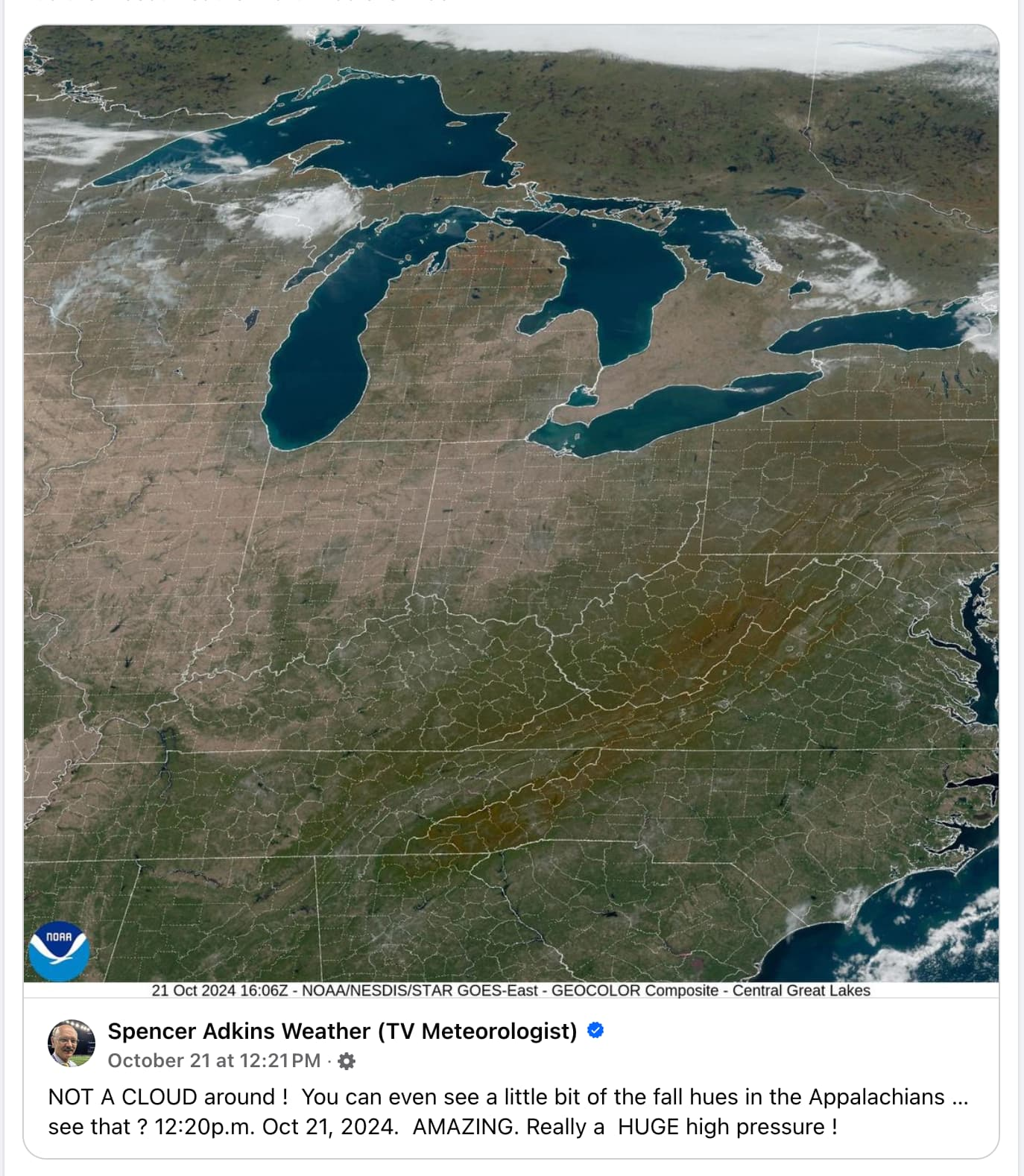
Whoa I didn’t know you could see state and county lines from space. I guess maps are more realistic than I thought!
Imagine how much work it must be to chalk those lines every time it rains.
Bro this ain’t the 1800s, we’re obviously using LED light strips for that now. The downside is that a single section goes dark and we lose mapping data for the entire northeast. Totally worth it though when they turn on the strobe effect.